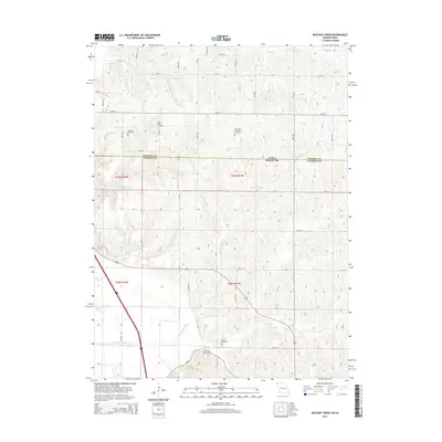
2014 Map of McElroy Creek
USGS Topo · Published 2014About this map
Iowa and Missouri state lines intersect with the Fremont and Atchison county borders in this rural landscape dominated by drainage networks and family burial grounds. The namesake McElroy Creek winds through the central terrain, part of a watershed that includes Mill Creek and High Creek. To the west, the managed water of High Creek Ditch and the presence of Greys Lake suggest a bottomland environment shaped by agricultural engineering. Genealogists will find a high density of documented burial sites scattered across the township, including Beehive Cemetery, Mount Olive Cemetery, and the Columbia and French Cemetery. The map also preserves the location of the Stoner Cemetery and High Creek Cemetery, which serve as quiet markers of the area's early settlement history among the surveyed sections and rural road grids.
Find a feature on this map
22 named features on this map. Tap any name to fly to it.
Don’t see what you’re looking for? This feature index may not catch every label — zoom into the map to look around manually.
Map Details
Editions of this 2014 McElroy Creek Map
This is the sole edition of this map. No revisions or reprints were ever made.
Other maps of this area

1915 · Nemaha
USGS Topo · 1:62,500

1939 · Tarkio
USGS Topo · 1:62,500

1939 · Farragut
USGS Topo · 1:62,500

1939 · Hamburg
USGS Topo · 1:62,500

1939 · Nemaha
USGS Topo · 1:62,500

1940 · Tarkio
USGS Topo · 1:62,500

1940 · Farragut
USGS Topo · 1:62,500

1941 · Tarkio
USGS Topo · 1:62,500

1941 · Hamburg
USGS Topo · 1:62,500

1949 · Nemaha
USGS Topo · 1:62,500