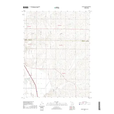
2017 Map of McElroy Creek
USGS Topo · Published 2017About this map
Atchison County, Missouri, meets the Iowa border in a landscape defined by the drainage of McElroy Creek and Mill Creek. This 2017 survey reveals a deeply agricultural region where the natural waterways have been supplemented by engineering, notably the High Creek Ditch in the southern portion of the quadrangle. The terrain is characterized by dissected uplands that fall away toward the Missouri River floodplain, visible in the western reaches near Greys Lake.
Find a feature on this map
33 named features on this map. Tap any name to fly to it.
Don’t see what you’re looking for? This feature index may not catch every label — zoom into the map to look around manually.
Map Details
Editions of this 2017 McElroy Creek Map
This is the sole edition of this map. No revisions or reprints were ever made.
Other maps of this area

1915 · Nemaha
USGS Topo · 1:62,500

1939 · Tarkio
USGS Topo · 1:62,500

1939 · Farragut
USGS Topo · 1:62,500

1939 · Hamburg
USGS Topo · 1:62,500

1939 · Nemaha
USGS Topo · 1:62,500

1940 · Tarkio
USGS Topo · 1:62,500

1940 · Farragut
USGS Topo · 1:62,500

1941 · Tarkio
USGS Topo · 1:62,500

1941 · Hamburg
USGS Topo · 1:62,500

1949 · Nemaha
USGS Topo · 1:62,500