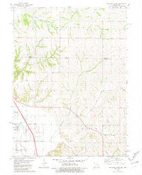
1981 Map of McElroy Creek
USGS Topo · Published 1981About this map
McElroy Creek flows through the heart of this landscape along the Iowa and Missouri border, serving as the central drainage for a region defined by agricultural field lines and small-scale water bodies. The terrain is marked by the presence of several significant genealogical landmarks, including Stoner Cem and the High Creek Ch with its adjacent High Creek Ch Cem. These religious and burial sites, alongside Mt Olive Ch, suggest a long-standing rural community structure centered around parish life and family tracts. To the west, the topography shifts near the Nishnabotna river area, where Greys Lake sits near the border of Buchanan and Polk townships. The presence of a Landing Strip and a Radio Tower indicates the intersection of traditional farming life with late-twentieth-century infrastructure and communication.
Find a feature on this map
18 named features on this map. Tap any name to fly to it.
Don’t see what you’re looking for? This feature index may not catch every label — zoom into the map to look around manually.
Map Details
Editions of this 1981 McElroy Creek Map
This is the sole edition of this map. No revisions or reprints were ever made.
Other maps of this area

1915 · Nemaha
USGS Topo · 1:62,500

1939 · Tarkio
USGS Topo · 1:62,500

1939 · Farragut
USGS Topo · 1:62,500

1939 · Hamburg
USGS Topo · 1:62,500

1939 · Nemaha
USGS Topo · 1:62,500

1940 · Tarkio
USGS Topo · 1:62,500

1940 · Farragut
USGS Topo · 1:62,500

1941 · Tarkio
USGS Topo · 1:62,500

1941 · Hamburg
USGS Topo · 1:62,500

1949 · Nemaha
USGS Topo · 1:62,500