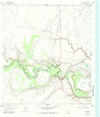
1962 Map of McFaddin
USGS Topo · Published 1984About this map
The San Antonio River meanders in tight oxbows across the coastal prairie, defining the border between Victoria and Refugio Counties. This mid-century landscape is dominated by ranching and petroleum extraction, with the Missouri Pacific railroad corridor serving as a vital link for the community of McFaddin. Local family histories are anchored by landmarks like the De La Garza Cem and the Nicholas Fagan Memorial Cem, while spiritual life is centered at Saint Dennis Ch and Mt Salem Ch. The industrial footprint is evident in the Fagan Oil Field and Anaqua Field, where numerous gas wells dot the terrain. Water features such as Kuy Creek and Cushman Bayou drain the low-lying McFaddin Flat, illustrating the complex hydrology of the Gulf Coast region during this era of development.
Find a feature on this map
25 named features on this map. Tap any name to fly to it.
Don’t see what you’re looking for? This feature index may not catch every label — zoom into the map to look around manually.
Map Details
Editions of this 1962 McFaddin Map
Other maps of this area

1951 · Bloomington
USGS Topo · 1:24,000

1952 · Tivoli
USGS Topo · 1:24,000

1952 · Bloomington SW
USGS Topo · 1:24,000

1953 · Beeville
USGS Topo · 1:250,000

1954 · Vidaurri
USGS Topo · 1:62,500

1956 · Beeville
USGS Topo · 1:250,000

1960 · Beeville
USGS Topo · 1:250,000

1962 · Fannin
USGS Topo · 1:24,000

1962 · Lott Lake
USGS Topo · 1:24,000

1962 · McFaddin
USGS Topo · 1:24,000