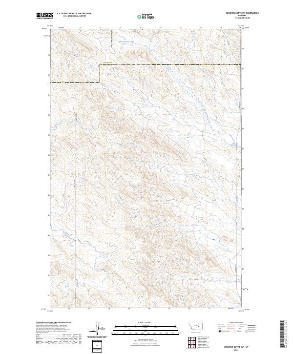
2024 Map of McGinnis Butte SW
USGS Topo · Published 2024About this map
Little McGinnis Creek and Big Breed Creek define the drainage patterns across this stretch of the Montana plains, situated along the boundary where Garfield and Rosebud Counties meet. This 2024 edition reflects a landscape primarily shaped by modern land management and ranching infrastructure, evidenced by the network of section lines and gravel roads. Local travel and access are facilitated by routes such as Gumbo Butte RD, which cuts across the central terrain, and Ingomar RD N to the east. The absence of concentrated settlements highlights the open-range character of the region, where the primary topographic identifiers remain the seasonal watercourses and the established township and range grids of t13n r34e and surrounding sections.
Find a feature on this map
12 named features on this map. Tap any name to fly to it.
Don’t see what you’re looking for? This feature index may not catch every label — zoom into the map to look around manually.
Map Details
Editions of this 2024 McGinnis Butte SW Map
This is the sole edition of this map. No revisions or reprints were ever made.
Other maps of this area

1954 · Forsyth
USGS Topo · 1:250,000

1957 · Forsyth
USGS Topo · 1:250,000

1958 · Forsyth
USGS Topo · 1:250,000

1960 · Yablonski Ranch
USGS Topo · 1:24,000

1960 · Black Sea Reservoir
USGS Topo · 1:24,000

1963 · Mc Williams Springs
USGS Topo · 1:24,000

1963 · Hecker Ranch
USGS Topo · 1:24,000

1963 · Regnal Coulee
USGS Topo · 1:24,000
1965 · Emma Butte
USGS Topo · 1:24,000
1965 · Mc Ginnis Butte
USGS Topo · 1:24,000