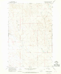
1965 Map of Mc Ginnis Butte
USGS Topo · Published 1968About this map
McGinnis Butte stands as the primary landmark in this remote section of Garfield County, overlooking a landscape defined by seasonal drainages and essential water sources. The map, based on 1964 aerial photography, reveals the vital role of natural springs in this arid region, marking both Peterson Spring and Geyser Spring. These water points, along with the winding course of Big Dry Creek and McGinnis Creek, likely served as critical infrastructure for the scattered ranching operations indicated by the network of fence lines.
Find a feature on this map
12 named features on this map. Tap any name to fly to it.
Don’t see what you’re looking for? This feature index may not catch every label — zoom into the map to look around manually.
Map Details
Editions of this 1965 Mc Ginnis Butte Map
2 editions found
Other maps of this area

1954 · Jordan
USGS Topo · 1:250,000

1954 · Forsyth
USGS Topo · 1:250,000

1956 · Jordan
USGS Topo · 1:250,000

1957 · Forsyth
USGS Topo · 1:250,000

1958 · Jordan
USGS Topo · 1:250,000

1958 · Forsyth
USGS Topo · 1:250,000

1963 · Mc Williams Springs
USGS Topo · 1:24,000

1963 · Regnal Coulee
USGS Topo · 1:24,000

1964 · Jordan
USGS Topo · 1:250,000

1965 · Robertson School
USGS Topo · 1:24,000