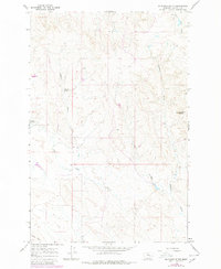
1965 Map of Mc Ginnis Butte
USGS Topo · Published 1980About this map
McGinnis Butte rises as a prominent landmark in this segment of Garfield County, anchoring a landscape defined by the drainage networks of Big Dry Creek and McGinnis Creek. The terrain is characterized by the complex erosion patterns typical of eastern Montana, with named features such as Peterson Coulee and Dry Coulee cutting through the upland plains. This mid-1960s survey, updated with late-1970s aerial data, reveals the isolated nature of local water sources, identifying specific points like Peterson Spring and Geyser Spring that were critical for ranching and livestock in the semi-arid environment. Human activity is sparsely recorded through the presence of various Drill Holes, suggesting exploratory resource interest. The geography is further delineated by Gumbo Ridge and Calf Creek, illustrating the localized nomenclature used by residents to navigate the breaks and ridges of the Missouri River plateau.
Find a feature on this map
13 named features on this map. Tap any name to fly to it.
Don’t see what you’re looking for? This feature index may not catch every label — zoom into the map to look around manually.
Map Details
Editions of this 1965 Mc Ginnis Butte Map
2 editions found
Other maps of this area

1954 · Jordan
USGS Topo · 1:250,000

1954 · Forsyth
USGS Topo · 1:250,000

1956 · Jordan
USGS Topo · 1:250,000

1957 · Forsyth
USGS Topo · 1:250,000

1958 · Jordan
USGS Topo · 1:250,000

1958 · Forsyth
USGS Topo · 1:250,000

1963 · Mc Williams Springs
USGS Topo · 1:24,000

1963 · Regnal Coulee
USGS Topo · 1:24,000

1964 · Jordan
USGS Topo · 1:250,000

1965 · Robertson School
USGS Topo · 1:24,000