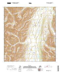
2019 Map of McGrath A-1 SE
USGS Topo · Published 2019About this map
The Alaska Range defines the high-altitude topography of this Bethel Census Area landscape, where natural corridors through the peaks have long served as vital pathways. Goodman Pass and Houston Pass mark significant navigational breaks in the mountain terrain, providing essential transitions between drainage basins. This 2019 survey documents a complex hydrological network centered on the Happy River, which collects flow from several tributaries including Denny Cr and the waters emanating from Ptarmigan Valley.
Find a feature on this map
19 named features on this map. Tap any name to fly to it.
Don’t see what you’re looking for? This feature index may not catch every label — zoom into the map to look around manually.
Map Details
Editions of this 2019 McGrath A-1 SE Map
This is the sole edition of this map. No revisions or reprints were ever made.
Other maps of this area

1949 · Tyonek
USGS Topo · 1:250,000

1949 · McGrath
USGS Topo · 1:250,000

1950 · McGrath
USGS Topo · 1:250,000

1950 · Talkeetna
USGS Topo · 1:250,000

1951 · Talkeetna
USGS Topo · 1:250,000

1951 · Tyonek
USGS Topo · 1:250,000

1951 · Lime Hills
USGS Topo · 1:250,000

1958 · Talkeetna A-6
USGS Topo · 1:63,360

1958 · McGrath A-1
USGS Topo · 1:63,360

1958 · Tyonek D-8
USGS Topo · 1:63,360