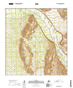
2019 Map of McGrath C-2 NW
USGS Topo · Published 2019About this map
The South Fork Kuskokwim River dominates the eastern and northern reaches of this terrain in the Yukon-Koyukuk Census Area. This part of Alaska is defined by its massive braided river systems and vast wetlands, where the main river channel is fed by the Salmon River flowing in from the west. The landscape is marked by intricate contour patterns that reveal the shifting hydrology of these glacial-fed waters as they move through the valley. The absence of roads or settlements on this 2019 survey emphasizes the isolation of the Alaska interior, where geographic features are the primary markers across the Public Land Survey System grids such as t31n r25w.
Find a feature on this map
8 named features on this map. Tap any name to fly to it.
Don’t see what you’re looking for? This feature index may not catch every label — zoom into the map to look around manually.
Map Details
Editions of this 2019 McGrath C-2 NW Map
This is the sole edition of this map. No revisions or reprints were ever made.
Other maps of this area

1949 · McGrath
USGS Topo · 1:250,000

1950 · McGrath
USGS Topo · 1:250,000

1954 · McGrath D-3
USGS Topo · 1:63,360

1954 · McGrath C-3
USGS Topo · 1:63,360

1958 · McGrath D-2
USGS Topo · 1:63,360

1958 · McGrath C-2
USGS Topo · 1:63,360

1958 · McGrath
USGS Topo · 1:250,000
2019 · McGrath D-2 SE
USGS Topo · 1:25,000
2019 · McGrath C-2 SW
USGS Topo · 1:25,000
2019 · McGrath C-2 SE
USGS Topo · 1:25,000