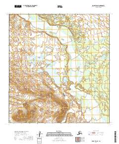
2019 Map of McGrath C-2 SE
USGS Topo · Published 2019About this map
The South Fork Kuskokwim River dominates this interior Alaskan landscape, carving a broad, braided course through the Yukon-Koyukuk region. In the south, the prominent rise of Farewell Mtn stands as a landmark overlooking the Tin Creek Airport and the surrounding wilderness. This area is defined by its complex hydrology, where the Dillinger River and Jones River join the larger Kuskokwim drainage amidst a series of remote water bodies, including Farewell Lake, Low Lake, and Submarine Lake. The network of small streams like Tin Cr and Steele Lake suggests the seasonal flow and varied terrain of this unpopulated stretch of the interior. The map illustrates a remote geography where aviation and river systems provide the primary points of reference for navigation and survival.
Find a feature on this map
15 named features on this map. Tap any name to fly to it.
Don’t see what you’re looking for? This feature index may not catch every label — zoom into the map to look around manually.
Map Details
Editions of this 2019 McGrath C-2 SE Map
This is the sole edition of this map. No revisions or reprints were ever made.
Other maps of this area

1949 · McGrath
USGS Topo · 1:250,000

1950 · McGrath
USGS Topo · 1:250,000

1958 · McGrath B-1
USGS Topo · 1:63,360

1958 · McGrath B-2
USGS Topo · 1:63,360

1958 · McGrath C-1
USGS Topo · 1:63,360

1958 · McGrath C-2
USGS Topo · 1:63,360

1958 · McGrath
USGS Topo · 1:250,000
2019 · McGrath C-2 SW
USGS Topo · 1:25,000
2019 · McGrath B-2 NW
USGS Topo · 1:25,000
2019 · McGrath C-1 SW
USGS Topo · 1:25,000