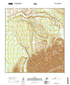
2019 Map of McGrath C-1 SW
USGS Topo · Published 2019About this map
Dillinger River and the Jones River define the hydrography of this interior landscape in the Alaska wilderness. The terrain is characterized by the transition from high-relief alpine slopes to the braided river channels and alluvial plains typical of the Yukon-Koyukuk region. This 2019 survey documents the intricate drainage patterns where smaller tributaries descend from high elevations to meet the major river systems. The lack of named settlements or road infrastructure highlights the remote character of the territory, which remains dominated by natural topographical features rather than human development. For the geologist or wilderness historian, the contour data reveals the complex glacial and fluvial activity that has shaped the land within these township boundaries.
Find a feature on this map
8 named features on this map. Tap any name to fly to it.
Don’t see what you’re looking for? This feature index may not catch every label — zoom into the map to look around manually.
Map Details
Editions of this 2019 McGrath C-1 SW Map
This is the sole edition of this map. No revisions or reprints were ever made.
Other maps of this area

1949 · McGrath
USGS Topo · 1:250,000

1950 · McGrath
USGS Topo · 1:250,000

1958 · McGrath B-1
USGS Topo · 1:63,360

1958 · McGrath B-2
USGS Topo · 1:63,360

1958 · McGrath C-1
USGS Topo · 1:63,360

1958 · McGrath C-2
USGS Topo · 1:63,360

1958 · McGrath
USGS Topo · 1:250,000
2017 · McGrath C-1 NE
USGS Topo · 1:25,000
2017 · McGrath B-1 NE
USGS Topo · 1:25,000
2019 · McGrath C-1 SE
USGS Topo · 1:25,000