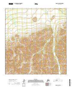
2019 Map of McGrath B-2 NW
USGS Topo · Published 2019About this map
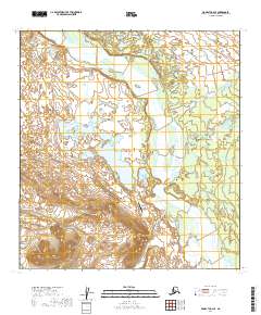
Saint Johns Hill rises as a prominent landmark in this interior Alaskan landscape, which is defined by the winding course of Sheep Creek. The drainage of the creek cuts through the eastern half of the terrain, while the topography rises steeply to the south and west. This 2019 survey documents a wilderness area within the Yukon-Koyukuk Census Area, showing the complex contour patterns of the Kuskokwim Mountains region. The lack of roads or established settlements emphasizes the remote nature of the territory, where surveying is largely concerned with the National Hydrography Dataset and public land boundaries. The map provides a detailed view of the natural water distribution and elevation changes across several townships, including T27n R25w and T28n R25w.
Find a feature on this map
10 named features on this map. Tap any name to fly to it.
Don’t see what you’re looking for? This feature index may not catch every label — zoom into the map to look around manually.
Map Details
Editions of this 2019 McGrath B-2 NW Map
This is the sole edition of this map. No revisions or reprints were ever made.
Other maps of this area

1949 · McGrath
USGS Topo · 1:250,000

1950 · McGrath
USGS Topo · 1:250,000

1954 · McGrath C-3
USGS Topo · 1:63,360

1958 · McGrath B-2
USGS Topo · 1:63,360

1958 · McGrath C-2
USGS Topo · 1:63,360
1958 · McGrath B-3
USGS Topo · 1:63,360

1958 · McGrath
USGS Topo · 1:250,000
2019 · McGrath B-2 SW
USGS Topo · 1:25,000
2019 · McGrath C-2 SW
USGS Topo · 1:25,000
2019 · McGrath C-2 SE
USGS Topo · 1:25,000