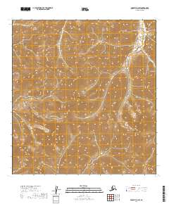
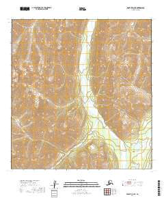
2019 Map of McGrath B-2 SW
USGS Topo · Published 2019About this map
The Alaska Range dominates this portion of the Yukon-Koyukuk Census Area, where the terrain is defined by extreme elevation changes and high-altitude drainage systems. The hydrologic network is centered on Sheep Creek, also labeled as Sheep Cr, which flows through steep-walled valleys in the southeastern sections of the quadrangle. This 2019 survey by the U.S. Geological Survey illustrates the intersection of several township and range lines, including t26n r25w and t25n r24w, in a landscape devoid of permanent human settlements or infrastructure. The map serves as a primary reference for the physical geography of this interior wilderness, capturing the precise contours of the ridges and the paths of the seasonal mountain runoff before it joins larger river systems to the west.
Find a feature on this map
9 named features on this map. Tap any name to fly to it.
Don’t see what you’re looking for? This feature index may not catch every label — zoom into the map to look around manually.
Map Details
Editions of this 2019 McGrath B-2 SW Map
This is the sole edition of this map. No revisions or reprints were ever made.
Other maps of this area

1949 · McGrath
USGS Topo · 1:250,000

1950 · McGrath
USGS Topo · 1:250,000

1958 · McGrath A-2
USGS Topo · 1:63,360

1958 · McGrath B-2
USGS Topo · 1:63,360

1958 · McGrath A-3
USGS Topo · 1:63,360
1958 · McGrath B-3
USGS Topo · 1:63,360

1958 · McGrath
USGS Topo · 1:250,000
2019 · McGrath B-2 NW
USGS Topo · 1:25,000
2019 · McGrath A-2 NW
USGS Topo · 1:25,000
2019 · McGrath A-2 NE
USGS Topo · 1:25,000