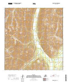
2019 Map of McGrath A-2 NE
USGS Topo · Published 2019About this map
Post River flows through the center of this wilderness area within the Yukon-Koyukuk Census Area, carving a path between significant elevations. To the east, the Terra Cotta Mountains rise sharply, flanked by the steep walls of Graptolite Canyon and the high elevations of Barren Ridge. This landscape is characterized by its isolation, with no recorded roads or human settlements, highlighting the remote nature of the Alaskan interior in the early 21st century. The drainage basin includes Post Lake in the southeast corner, which serves as a notable hydrologic feature in this mountainous terrain. The map provides a detailed view of the natural topography and township boundaries, such as t25n r24w and t24n r23w, documenting a portion of Alaska where the physical environment remains the primary focus of the survey.
Find a feature on this map
9 named features on this map. Tap any name to fly to it.
Don’t see what you’re looking for? This feature index may not catch every label — zoom into the map to look around manually.
Map Details
Editions of this 2019 McGrath A-2 NE Map
This is the sole edition of this map. No revisions or reprints were ever made.
Other maps of this area

1949 · McGrath
USGS Topo · 1:250,000

1950 · McGrath
USGS Topo · 1:250,000

1958 · McGrath B-1
USGS Topo · 1:63,360

1958 · McGrath A-2
USGS Topo · 1:63,360

1958 · McGrath A-1
USGS Topo · 1:63,360

1958 · McGrath B-2
USGS Topo · 1:63,360

1958 · McGrath
USGS Topo · 1:250,000
2019 · McGrath A-2 SE
USGS Topo · 1:25,000
2019 · McGrath B-2 SW
USGS Topo · 1:25,000
2019 · McGrath A-2 NW
USGS Topo · 1:25,000