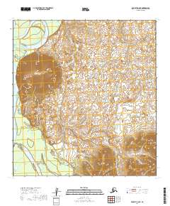
2019 Map of McGrath C-6 NE
USGS Topo · Published 2019About this map
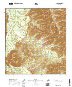
Vinasale Mtn rises prominently above the complex wetlands of the Kuskokwim River valley in this remote stretch of the Alaska interior. The landscape is defined by an intricate network of small lakes and ponds that fill the low-lying terrain between the mountain and the river's winding course. This 2019 survey documents the natural hydrography and elevation of the Yukon-Koyukuk region, emphasizing the isolation of the terrain where no roads or established settlements appear. The presence of Vinasale Mtn provides a significant landmark for navigating this section of the river corridor, which remains largely defined by its seasonal wetlands and the shifting patterns of the Kuskokwim River watershed.
Find a feature on this map
10 named features on this map. Tap any name to fly to it.
Don’t see what you’re looking for? This feature index may not catch every label — zoom into the map to look around manually.
Map Details
Editions of this 2019 McGrath C-6 NE Map
This is the sole edition of this map. No revisions or reprints were ever made.
Other maps of this area

1949 · McGrath
USGS Topo · 1:250,000

1950 · McGrath
USGS Topo · 1:250,000

1953 · McGrath D-5
USGS Topo · 1:63,360

1954 · McGrath D-6
USGS Topo · 1:63,360

1954 · McGrath C-6
USGS Topo · 1:63,360
1955 · McGrath C-5
USGS Topo · 1:63,360

1958 · McGrath
USGS Topo · 1:250,000
2019 · McGrath C-6 SW
USGS Topo · 1:25,000
2019 · McGrath C-5 SW
USGS Topo · 1:25,000
2019 · McGrath C-6 SE
USGS Topo · 1:25,000