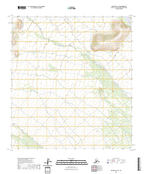
2024 Map of McGrath D-1 NE
USGS Topo · Published 2024About this map
Braided river systems and glacial meltwaters define the interior Alaskan landscape in this remote section of the Yukon-Koyukuk region. The Tonzona River skirts the northeastern corner of the map, while its tributary, the Little Tonzona River, cuts across the southwestern reaches. Central to this survey is the drainage of Pingston Creek, which winds through the central corridor alongside the distinct channels of Jones Creek and North Fork Jones Creek. These waterways provide critical orientation in a wilderness marked by significant elevation changes, ranging from the lowlands of the Clear Fork to the high ridges of the northeastern mountains. The absence of roads or permanent structures underscores the isolation of this terrain, reflecting the character of the Alaska Range's northern foothills in the early twenty-first century.
Find a feature on this map
16 named features on this map. Tap any name to fly to it.
Don’t see what you’re looking for? This feature index may not catch every label — zoom into the map to look around manually.
Map Details
Editions of this 2024 McGrath D-1 NE Map
This is the sole edition of this map. No revisions or reprints were ever made.
Other maps of this area

1949 · McGrath
USGS Topo · 1:250,000

1950 · Medfra
USGS Topo · 1:250,000

1950 · McGrath
USGS Topo · 1:250,000

1950 · Talkeetna
USGS Topo · 1:250,000

1951 · Talkeetna
USGS Topo · 1:250,000

1952 · Mount McKinley
USGS Topo · 1:250,000

1958 · Talkeetna D-6
USGS Topo · 1:63,360

1958 · Talkeetna
USGS Topo · 1:250,000

1958 · Medfra A-1
USGS Topo · 1:63,360

1958 · McGrath D-1
USGS Topo · 1:63,360