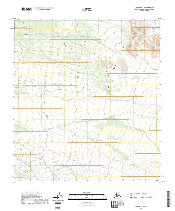
2024 Map of McGrath D-1 NW
USGS Topo · Published 2024About this map
Birch Hills rises above a vast network of glacial runoff and tundra drainages in this remote section of the Yukon-Koyukuk Census Area. The landscape is defined by the sinuous path of the Little Tonzona River as it traverses the southern portion of the quadrangle, while Jones Creek and its tributary, South Fork Jones Creek, drain the northern highlands. The lack of roads or established settlements reflects the wilderness character of the Alaska interior, where the primary landmarks are these ancient waterways and the varied elevations of the local topography. Researchers can trace the braided patterns of the Clear Fork and observe how the terrain shifts toward the higher elevations near the northeast corner.
Find a feature on this map
14 named features on this map. Tap any name to fly to it.
Don’t see what you’re looking for? This feature index may not catch every label — zoom into the map to look around manually.
Map Details
Editions of this 2024 McGrath D-1 NW Map
This is the sole edition of this map. No revisions or reprints were ever made.
Other maps of this area

1949 · McGrath
USGS Topo · 1:250,000

1950 · Medfra
USGS Topo · 1:250,000

1950 · McGrath
USGS Topo · 1:250,000

1958 · McGrath D-2
USGS Topo · 1:63,360

1958 · Medfra A-2
USGS Topo · 1:63,360

1958 · Medfra A-1
USGS Topo · 1:63,360

1958 · McGrath D-1
USGS Topo · 1:63,360

1958 · McGrath
USGS Topo · 1:250,000

1959 · Medfra
USGS Topo · 1:250,000
2017 · McGrath D-1 NE
USGS Topo · 1:25,000