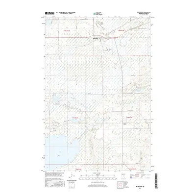
2016 Map of McGregor
USGS Topo · Published 2016About this map
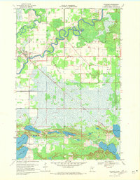
The town of McGregor and the smaller community of East Lake anchor this 2016 survey of central Aitkin County, where the landscape is defined by extensive wetlands and an intricate network of waterways. The Rice River and the Rice River Pool dominate the southwestern portion of the sheet, feeding into the expansive Rice Lake. This geography necessitated a specialized system of access, including the N Bog Trail and the CCC Trail, which reflect the historic and ongoing management of these sensitive marshlands. Local heritage is preserved at the Union Cem and Carr Memorial Cem located just south of the main town site.
Find a feature on this map
49 named features on this map. Tap any name to fly to it.
Don’t see what you’re looking for? This feature index may not catch every label — zoom into the map to look around manually.
Map Details
Editions of this 2016 McGregor Map
This is the sole edition of this map. No revisions or reprints were ever made.
Other maps of this area

1953 · Duluth
USGS Topo · 1:250,000

1958 · Duluth
USGS Topo · 1:250,000
1969 · Thor NE
USGS Topo · 1:24,000
1969 · Thor
USGS Topo · 1:24,000
1969 · Split Rock Lake
USGS Topo · 1:24,000
1969 · Lawler
USGS Topo · 1:24,000
1970 · Kimberly
USGS Topo · 1:24,000
1970 · Mc Gregor
USGS Topo · 1:24,000
1970 · Tamarack
USGS Topo · 1:24,000
1970 · Palisade
USGS Topo · 1:24,000