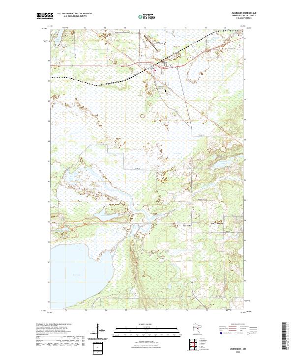
2022 Map of McGregor
USGS Topo · Published 2022About this map
McGregor serves as the primary hub in this Aitkin County landscape, situated at the junction of modern transit corridors and the historic path of the Soo Line North: Aitkin Trl. The surrounding terrain is defined by a dense network of wetlands and water bodies, including the expansive Rice Lake and the Rice River Pool. These water systems, fed by the Sandy River and Wakefield Brook, dominate the southern and central portions of the map, illustrating the region's importance for local hydrology and habitat. Local history is anchored by the Union Cem and Carr Memorial Cem just south of the main township, while the small settlement of East Lake sits further east along the highway. To the north, the Isedor Iverson Airport represents the local infrastructure, positioned near the town's industrial core. A variety of recreational paths like the Mandy Lake Trl and North Bog Trl suggest a modern landscape integrated with the natural bog environment.
Find a feature on this map
51 named features on this map. Tap any name to fly to it.
Don’t see what you’re looking for? This feature index may not catch every label — zoom into the map to look around manually.
Map Details
Editions of this 2022 McGregor Map
This is the sole edition of this map. No revisions or reprints were ever made.
Other maps of this area

1953 · Duluth
USGS Topo · 1:250,000

1958 · Duluth
USGS Topo · 1:250,000

1969 · Thor NE
USGS Topo · 1:24,000

1969 · Thor
USGS Topo · 1:24,000

1969 · Split Rock Lake
USGS Topo · 1:24,000

1969 · Lawler
USGS Topo · 1:24,000

1970 · Kimberly
USGS Topo · 1:24,000

1970 · Mc Gregor
USGS Topo · 1:24,000

1970 · Tamarack
USGS Topo · 1:24,000

1970 · Palisade
USGS Topo · 1:24,000