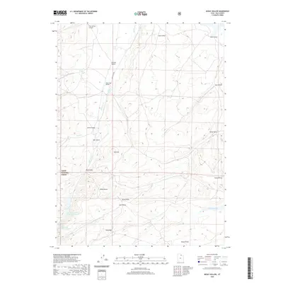
2020 Map of McKay Hollow
USGS Topo · Published 2020About this map
Cache National Forest boundaries encompass the southern portion of this high-elevation landscape in Rich County, where a network of seasonal drainages and named hollows defines the terrain. The map details a cattle-ranching landscape marked by Main Ranch Way and several developed water sources, including Saleratus Reservoir Number 2, Saleratus Reservoir Number 3, and Crane Reservoir. High ridges such as Table Mtn, McKay Ridge, and Lake Ridge separate the various watersheds, including McKay Hollow and Lake Hollow. The inclusion of named springs like Chicken Spring, Negro Dan Spring, and Keg Spring indicates the critical importance of water management in this arid mountainous region. This survey captures the land as it appeared in the early 21st century, showing the intersection of federal forest lands and private ranching interests through its precise mapping of drainage systems and boundary lines.
Find a feature on this map
27 named features on this map. Tap any name to fly to it.
Don’t see what you’re looking for? This feature index may not catch every label — zoom into the map to look around manually.
Map Details
Editions of this 2020 McKay Hollow Map
This is the sole edition of this map. No revisions or reprints were ever made.
Other maps of this area

1954 · Ogden
USGS Topo · 1:250,000

1958 · Ogden
USGS Topo · 1:250,000

1960 · Ogden
USGS Topo · 1:250,000

1964 · Francis Canyon
USGS Topo · 1:24,000

1968 · Wahsatch
USGS Topo · 1:24,000

1968 · Shearing Corral
USGS Topo · 1:24,000

1968 · Mc Kay Hollow
USGS Topo · 1:24,000

1968 · Neponset Reservoir NE
USGS Topo · 1:24,000

1968 · Meachum Ridge
USGS Topo · 1:24,000

1968 · Peck Canyon
USGS Topo · 1:24,000