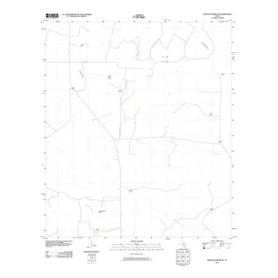
2010 Map of McKegan Draw NE
USGS Topo · Published 2010About this map
Large family-held ranching operations define this West Texas landscape in Schleicher County. The map reveals a land structured around seasonal drainage systems, most notably West Bear Creek and the meandering Rattlesnake Draw, which drain the arid plateau. The presence of the Lopez Ranch Airport near Lopez Ranch highlights the logistical necessities of managing expansive remote properties where air travel and ranch roads like Mc Gowan Ranch Rd provide critical connectivity.
Find a feature on this map
23 named features on this map. Tap any name to fly to it.
Don’t see what you’re looking for? This feature index may not catch every label — zoom into the map to look around manually.
Map Details
Editions of this 2010 McKegan Draw NE Map
This is the sole edition of this map. No revisions or reprints were ever made.
Other maps of this area

1893 · Fort McKavett
USGS Topo · 1:125,000

1954 · Llano
USGS Topo · 1:250,000

1954 · Sonora
USGS Topo · 1:250,000

1955 · Llano
USGS Topo · 1:250,000

1956 · Llano
USGS Topo · 1:250,000

1958 · Sonora
USGS Topo · 1:250,000

1963 · McKegan Draw
USGS Topo · 1:24,000
1963 · Brokeleg Mountain
USGS Topo · 1:24,000
1963 · Coal Kiln Draw
USGS Topo · 1:24,000

1963 · McKegan Draw NE
USGS Topo · 1:24,000