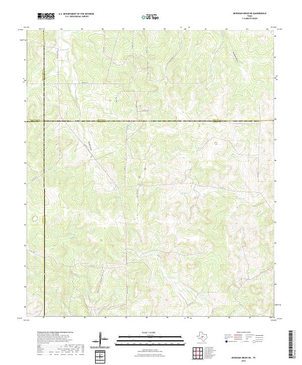
2022 Map of McKegan Draw NE
USGS Topo · Published 2022About this map
The intersection of four Texas counties — Schleicher, Sutton, Menard, and Kimble — defines this 2022 survey of the Edwards Plateau. The landscape is dominated by a complex network of ephemeral drainage systems, including Rattlesnake Draw, Colston Draw, and Campbell Draw. These features, along with the headwaters of East Copperas Creek, Middle Copperas Creek, and West Bear Creek, illustrate the dissected topography of this ranching country. While the region remains sparsely populated, a grid of private roads and local routes such as McGowan Ranch Road, Morales Lane, and Ridge Top Drive provide access to the vast ranch lands. This modern topographic record captures the enduring rural character of the divide where multiple county lines converge near Ranch Rd 1674.
Find a feature on this map
29 named features on this map. Tap any name to fly to it.
Don’t see what you’re looking for? This feature index may not catch every label — zoom into the map to look around manually.
Map Details
Editions of this 2022 McKegan Draw NE Map
This is the sole edition of this map. No revisions or reprints were ever made.
Other maps of this area

1893 · Fort McKavett
USGS Topo · 1:125,000

1954 · Llano
USGS Topo · 1:250,000

1954 · Sonora
USGS Topo · 1:250,000

1955 · Llano
USGS Topo · 1:250,000

1956 · Llano
USGS Topo · 1:250,000

1958 · Sonora
USGS Topo · 1:250,000

1963 · McKegan Draw
USGS Topo · 1:24,000
1963 · Brokeleg Mountain
USGS Topo · 1:24,000
1963 · Coal Kiln Draw
USGS Topo · 1:24,000

1963 · McKegan Draw NE
USGS Topo · 1:24,000