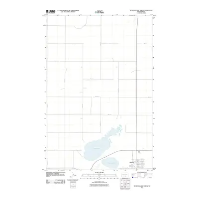
2011 Map of McKenna Lake North
USGS Topo · Published 2011About this map
Napoleon sits at the southern edge of this North Dakota landscape, organized by a precise grid of rural section roads and residential streets. The community's eastern expansion is marked by a series of alphabetically named thoroughfares, from Avenue A E to Avenue G E, reflecting a structured period of mid-century development. Just north of the town center, Saint Philips Cemetery provides a significant touchstone for genealogists and local historians tracing the heritage of Logan County's early settlers.
Find a feature on this map
31 named features on this map. Tap any name to fly to it.
Don’t see what you’re looking for? This feature index may not catch every label — zoom into the map to look around manually.
Map Details
Editions of this 2011 McKenna Lake North Map
This is the sole edition of this map. No revisions or reprints were ever made.
Other maps of this area

1953 · Jamestown
USGS Topo · 1:250,000

1956 · Jamestown
USGS Topo · 1:250,000

1975 · Kintyre
USGS Topo · 1:24,000

1979 · Kintyre NE
USGS Topo · 1:24,000

1979 · Schell Buttes NW
USGS Topo · 1:24,000

1979 · McKenna Lake South
USGS Topo · 1:24,000

1980 · McKenna Lake North
USGS Topo · 1:24,000

1982 · Burnstad
USGS Topo · 1:24,000

1983 · Alkaline Lake SW
USGS Topo · 1:24,000

1983 · Alkaline Lake NW
USGS Topo · 1:24,000