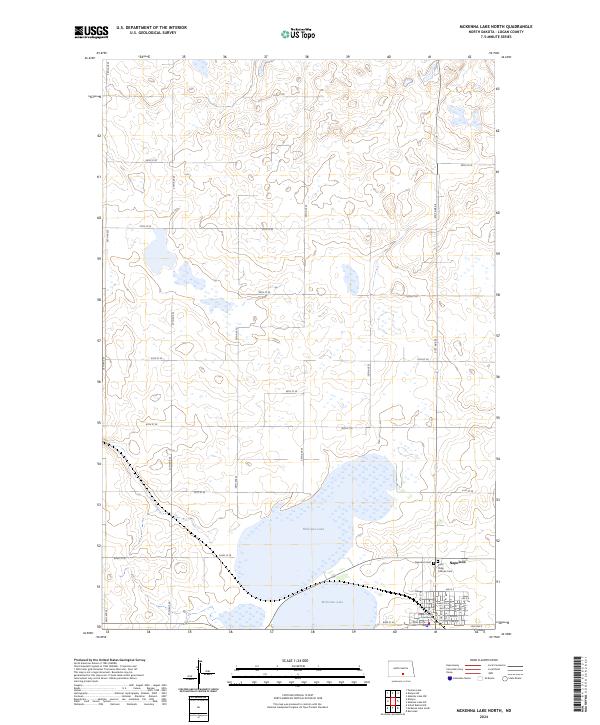
2024 Map of McKenna Lake North
USGS Topo · Published 2024About this map
The city of Napoleon serves as the focal point in the southeast corner of this North Dakota landscape, anchoring a region defined by its prairie wetlands and section-line roads. The township grid is clearly marked by a series of numbered avenues and streets, including 26th Ave SE and 55th St SE, which partition the undulating terrain. Within the town site, the Logan County Courthouse stands as a primary landmark alongside local religious and burial grounds like the Saint Philip Catholic Cem and the Napoleon Cem. North of the settlement, the expansive McKenna Lake dominates the central terrain, surrounded by numerous unnamed seasonal wetlands and potholes characteristic of this glaciated geography. The map provides a precise look at the 2024 configuration of this agricultural hub and its surrounding sections.
Find a feature on this map
34 named features on this map. Tap any name to fly to it.
Don’t see what you’re looking for? This feature index may not catch every label — zoom into the map to look around manually.
Map Details
Editions of this 2024 McKenna Lake North Map
This is the sole edition of this map. No revisions or reprints were ever made.
Other maps of this area

1953 · Jamestown
USGS Topo · 1:250,000

1956 · Jamestown
USGS Topo · 1:250,000

1975 · Kintyre
USGS Topo · 1:24,000

1979 · Kintyre NE
USGS Topo · 1:24,000

1979 · Schell Buttes NW
USGS Topo · 1:24,000

1979 · McKenna Lake South
USGS Topo · 1:24,000

1980 · McKenna Lake North
USGS Topo · 1:24,000

1982 · Burnstad
USGS Topo · 1:24,000

1983 · Alkaline Lake SW
USGS Topo · 1:24,000

1983 · Alkaline Lake NW
USGS Topo · 1:24,000