
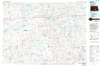
1980 Map of McKenna Lake North
USGS Topo · Published 1980About this map
Napoleon serves as a primary settlement hub in this Logan County landscape, situated at a key rail junction during the late 1970s. The Soo Line railroad cuts across the prairie, anchoring the local economy and defining the transport corridors between rural townships. Near the village, the St Philips Cem provides a point of interest for genealogists tracing local families in the Bryant and Kroeber districts.
Find a feature on this map
12 named features on this map. Tap any name to fly to it.
Don’t see what you’re looking for? This feature index may not catch every label — zoom into the map to look around manually.
Map Details
Editions of this 1980 McKenna Lake North Map
This is the sole edition of this map. No revisions or reprints were ever made.
Other maps of this area

1953 · Jamestown
USGS Topo · 1:250,000

1956 · Jamestown
USGS Topo · 1:250,000

1975 · Kintyre
USGS Topo · 1:24,000

1979 · Kintyre NE
USGS Topo · 1:24,000

1979 · Schell Buttes NW
USGS Topo · 1:24,000

1979 · McKenna Lake South
USGS Topo · 1:24,000

1982 · Burnstad
USGS Topo · 1:24,000

1983 · Alkaline Lake SW
USGS Topo · 1:24,000

1983 · Alkaline Lake NW
USGS Topo · 1:24,000
1985 · Steele
USGS Topo · 1:100,000