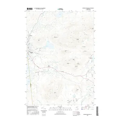
2016 Map of McKenzie Mountain
USGS Topo · Published 2016About this map
Saranac Lake and the surrounding high peaks define this 2016 study of the Adirondack landscape. The settlement of Trudeau sits at the northern edge of the village, while the central corridor follows Rte 86 toward the smaller community of Ray Brook. The terrain is dominated by prominent summits including McKenzie Mountain, Haystack Mtn, and the southern slopes of Whiteface. These peaks overlook a complex network of waterways, from the Saranac River and Lake Flower to the secluded McKenzie Pond.
Find a feature on this map
81 named features on this map. Tap any name to fly to it.
Don’t see what you’re looking for? This feature index may not catch every label — zoom into the map to look around manually.
Map Details
Editions of this 2016 McKenzie Mountain Map
This is the sole edition of this map. No revisions or reprints were ever made.
Other maps of this area

1895 · Mt. Marcy
USGS Topo · 1:62,500

1896 · Lake Placid
USGS Topo · 1:62,500

1898 · Lake Placid
USGS Topo · 1:62,500

1902 · Mt. Marcy
USGS Topo · 1:62,500

1902 · Saranac
USGS Topo · 1:62,500

1904 · Saranac
USGS Topo · 1:62,500

1904 · Santanoni
USGS Topo · 1:62,500

1948 · Ogdensburg
USGS Topo · 1:250,000

1950 · Lake Champlain
USGS Topo · 1:250,000

1951 · Ogdensburg
USGS Topo · 1:250,000