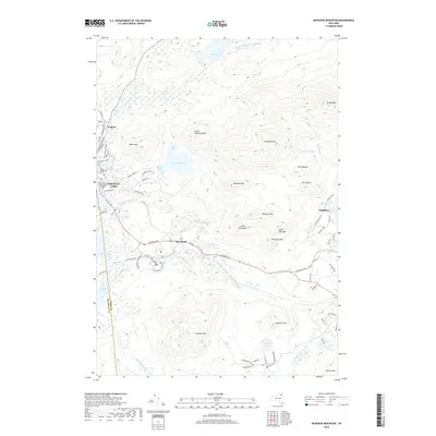
2019 Map of McKenzie Mountain
USGS Topo · Published 2019About this map
Saranac Lake anchors this landscape in the High Peaks region, where early 20th-century history meets a complex network of waterways and summits. The northern reach of the village is marked by the Trudeau settlement and the Pine Ridge Cem, while the North Country Community College campus sits near the banks of Lake Flower. This area is defined by its transition from village life to the protected wilderness of the Adirondack Park, where elevations rise sharply toward McKenzie Mtn and Haystack Mtn.
Find a feature on this map
85 named features on this map. Tap any name to fly to it.
Don’t see what you’re looking for? This feature index may not catch every label — zoom into the map to look around manually.
Map Details
Editions of this 2019 McKenzie Mountain Map
This is the sole edition of this map. No revisions or reprints were ever made.
Other maps of this area

1895 · Mt. Marcy
USGS Topo · 1:62,500

1896 · Lake Placid
USGS Topo · 1:62,500

1898 · Lake Placid
USGS Topo · 1:62,500

1902 · Mt. Marcy
USGS Topo · 1:62,500

1902 · Saranac
USGS Topo · 1:62,500

1904 · Saranac
USGS Topo · 1:62,500

1904 · Santanoni
USGS Topo · 1:62,500

1948 · Ogdensburg
USGS Topo · 1:250,000

1950 · Lake Champlain
USGS Topo · 1:250,000

1951 · Ogdensburg
USGS Topo · 1:250,000