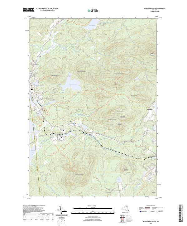
2023 Map of McKenzie Mountain
USGS Topo · Published 2023About this map
McKenzie Mountain and its neighboring peaks dominate this 2023 survey of the Adirondack landscape at the border of Essex and Franklin counties. The map captures the settled corridor along Saranac Ave and Rte 86, connecting the communities of Trudeau, Ray Brook, and the western edge of Lake Placid. This era shows a landscape managed for both education and recreation, featuring the campus of North Country Community College and a dense network of trails such as the Jackrabbit Trl and Osetah Lake Trails Trl.
Find a feature on this map
95 named features on this map. Tap any name to fly to it.
Don’t see what you’re looking for? This feature index may not catch every label — zoom into the map to look around manually.
Map Details
Editions of this 2023 McKenzie Mountain Map
This is the sole edition of this map. No revisions or reprints were ever made.
Other maps of this area

1895 · Mt. Marcy
USGS Topo · 1:62,500

1896 · Lake Placid
USGS Topo · 1:62,500

1898 · Lake Placid
USGS Topo · 1:62,500

1902 · Mt. Marcy
USGS Topo · 1:62,500

1902 · Saranac
USGS Topo · 1:62,500

1904 · Saranac
USGS Topo · 1:62,500

1904 · Santanoni
USGS Topo · 1:62,500

1948 · Ogdensburg
USGS Topo · 1:250,000

1950 · Lake Champlain
USGS Topo · 1:250,000

1951 · Ogdensburg
USGS Topo · 1:250,000