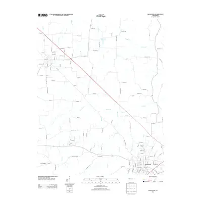
2013 Map of McKenzie
USGS Topo · Published 2013About this map
The railroad town of McKenzie serves as the focal point of this Northwest Tennessee landscape, situated where the terrain transitions into the drainage basins of the Obion River system. Water features dominate the rural sections, with Middle Fork Obion Lake and the winding course of Tumbling Cr in the north, while Spring Creek and its many tributaries like Boaz Cr and Wrinkley Br crisscross the southern farmlands. Smaller outlying communities like Tumbling and Greenhills are connected by a dense network of country roads, including Bell Store Rd and Janes Mill Rd, which reflect the area's agricultural foundations. The map reveals how the local geography is defined by the numerous small branches—such as Morris Br, Booth Br, and Bond Br—that have historically influenced property lines and transport routes throughout Carroll County.
Find a feature on this map
133 named features on this map. Tap any name to fly to it.
Don’t see what you’re looking for? This feature index may not catch every label — zoom into the map to look around manually.
Map Details
Editions of this 2013 McKenzie Map
This is the sole edition of this map. No revisions or reprints were ever made.
Other maps of this area

1950 · Osage
USGS Topo · 1:24,000

1952 · Dresden
USGS Topo · 1:24,000

1955 · Henry
USGS Topo · 1:24,000

1955 · Huntingdon
USGS Topo · 1:24,000

1956 · Dyersburg
USGS Topo · 1:250,000

1957 · Como
USGS Topo · 1:24,000

1966 · Trezevant West
USGS Topo · 1:24,000

1967 · Pillowville
USGS Topo · 1:24,000
1967 · Trezevant East
USGS Topo · 1:24,000
1967 · Mc Kenzie
USGS Topo · 1:24,000