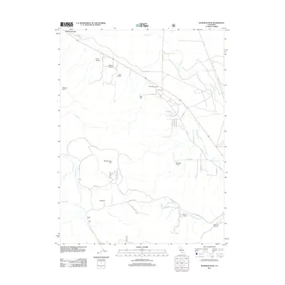
2012 Map of McKesick Peak
USGS Topo · Published 2012About this map
Herlong Junction sits at the northern edge of this high-altitude landscape, where the road network transitions from the paved corridors of Old Hwy into the winding mountain passes of Doyle Grade. The terrain is defined by dramatic elevation changes, rising from the waters of Long Valley Cr and Willow Ranch Cr toward prominent landmarks like McKesick Peak and Meadow View Peak. The drainage patterns of Last Chance Cr and Bird Cr underscore the complex topography of the Bird Hills and Sugarloaf formations.
Find a feature on this map
39 named features on this map. Tap any name to fly to it.
Don’t see what you’re looking for? This feature index may not catch every label — zoom into the map to look around manually.
Map Details
Editions of this 2012 McKesick Peak Map
This is the sole edition of this map. No revisions or reprints were ever made.
Other maps of this area

1886 · Honey Lake
USGS Topo · 1:250,000

1890 · Sierraville
USGS Topo · 1:125,000

1891 · Honey Lake
USGS Topo · 1:250,000

1892 · Sierraville
USGS Topo · 1:125,000

1893 · Honey Lake
USGS Topo · 1:250,000

1894 · Sierraville
USGS Topo · 1:125,000

1950 · Chilcoot
USGS Topo · 1:62,500

1950 · Portola
USGS Topo · 1:62,500

1950 · Milford
USGS Topo · 1:62,500

1954 · Doyle
USGS Topo · 1:62,500