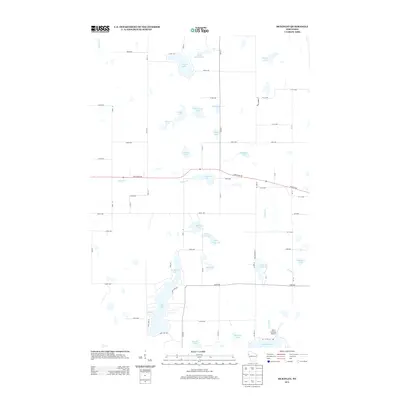
2013 Map of McKinley
USGS Topo · Published 2013About this map
Pipe Lake and its smaller counterpart, North Pipe Lake, dominate the southwestern corner of this glaciated landscape along the border of Polk and Barron counties. The terrain is defined by an intricate network of water bodies, including Largon Lake and Lake of the Woods, interspersed among a grid of rural roads and agricultural plots. Running east-west across the center, State Road 48 provides the primary transit artery, passing just south of Grenquist Lake. In the south, near the junction of Staples Cr, Mort's Landing Airport stands as a notable landmark for local aviation. The northern reaches are drained by the Clam River and Sucker Cr, illustrating the typical hydrology of Northwest Wisconsin where numerous named lakes like Snowshoe Lake and Johnson Lake dot the township.
Find a feature on this map
55 named features on this map. Tap any name to fly to it.
Don’t see what you’re looking for? This feature index may not catch every label — zoom into the map to look around manually.
Map Details
Editions of this 2013 McKinley Map
This is the sole edition of this map. No revisions or reprints were ever made.
Other maps of this area

1950 · Balsam Lake
USGS Topo · 1:62,500

1950 · Turtle Lake
USGS Topo · 1:62,500

1951 · Cumberland
USGS Topo · 1:48,000

1951 · Frederic
USGS Topo · 1:48,000

1952 · Turtle Lake
USGS Topo · 1:62,500

1953 · Stillwater
USGS Topo · 1:250,000

1955 · Frederic
USGS Topo · 1:62,500

1955 · Stillwater
USGS Topo · 1:250,000

1956 · Cumberland
USGS Topo · 1:62,500

1958 · Stillwater
USGS Topo · 1:250,000