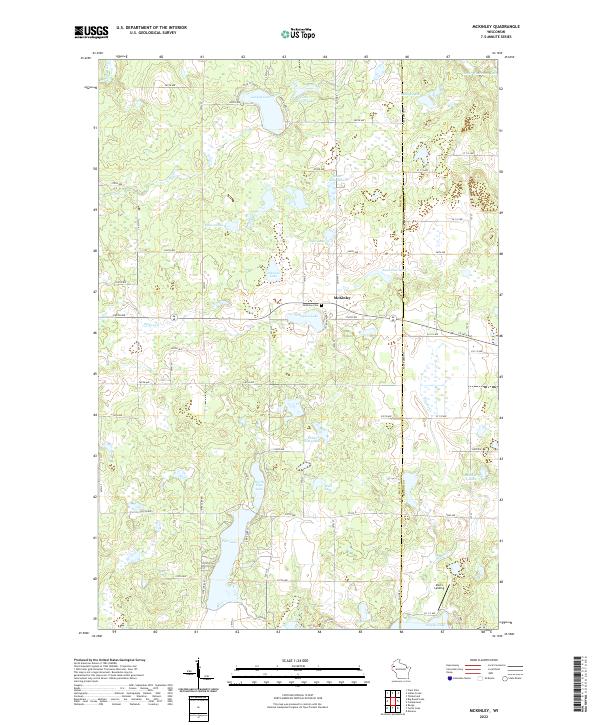
2022 Map of McKinley
USGS Topo · Published 2022About this map
McKinley sits at the heart of this northwestern Wisconsin landscape, where the boundary between Polk and Barron counties defines the eastern edge of the township. The area is dominated by a dense network of glacial water bodies, including the large Pipe Lake and its northern neighbor North Pipe Lake, which feed into the surrounding wetlands. This environment shaped a settlement pattern of small lakeside communities and localized landmarks like Mort's Landing on the shores of Staples Lake.
Find a feature on this map
55 named features on this map. Tap any name to fly to it.
Don’t see what you’re looking for? This feature index may not catch every label — zoom into the map to look around manually.
Map Details
Editions of this 2022 McKinley Map
This is the sole edition of this map. No revisions or reprints were ever made.
Other maps of this area

1950 · Balsam Lake
USGS Topo · 1:62,500

1950 · Turtle Lake
USGS Topo · 1:62,500

1951 · Cumberland
USGS Topo · 1:48,000

1951 · Frederic
USGS Topo · 1:48,000

1952 · Turtle Lake
USGS Topo · 1:62,500

1953 · Stillwater
USGS Topo · 1:250,000

1955 · Frederic
USGS Topo · 1:62,500

1955 · Stillwater
USGS Topo · 1:250,000

1956 · Cumberland
USGS Topo · 1:62,500

1958 · Stillwater
USGS Topo · 1:250,000