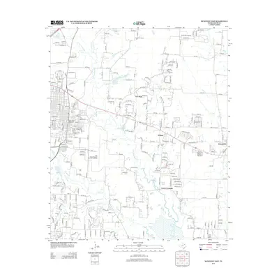
2013 Map of McKinney East
USGS Topo · Published 2013About this map
The E Fork Trinity River carves a winding path through this portion of Collin County, defining the agricultural and residential landscape east of the county seat. This 2013 survey captures the area during a period of suburban expansion, where traditional communities like New Hope and Milligan are increasingly connected by a network of Farm to Market roads such as FM-546 and FM-1827. The eastern edge of the map shows the growing town of Princeton, while the southern reaches feature the community of Lowry Crossing near the confluence of Wilson Cr and Sloan Cr.
Find a feature on this map
186 named features on this map. Tap any name to fly to it.
Don’t see what you’re looking for? This feature index may not catch every label — zoom into the map to look around manually.
Map Details
Editions of this 2013 McKinney East Map
This is the sole edition of this map. No revisions or reprints were ever made.
Other maps of this area

1924 · Farmersville 3-c
USGS Topo · 1:48,000

1924 · Mc Kinney 4-d
USGS Topo · 1:48,000

1929 · McKinney
USGS Topo · 1:62,500

1930 · Farmersville
USGS Topo · 1:62,500

1954 · Sherman
USGS Topo · 1:250,000

1958 · Sherman
USGS Topo · 1:250,000

1959 · Wylie
USGS Topo · 1:24,000

1960 · McKinney East
USGS Topo · 1:24,000

1960 · Plano
USGS Topo · 1:24,000

1960 · Blue Ridge
USGS Topo · 1:24,000