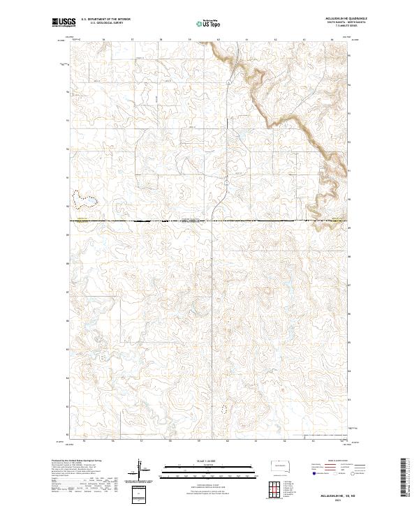
2021 Map of McLaughlin NE
USGS Topo · Published 2021About this map
North Dakota South Dakota state boundaries and the Sioux Co Corson Co border define this high-plains landscape. The winding course of Oak Creek—also labeled as Oak Cr—dominates the southern half of the quadrangle, carving through the terrain where North and South Dakota meet. This 2021 survey by the U.S. Geological Survey illustrates a sparse network of section-line roads, including 100th St, 99th St, and 22nd Ave, which provide the primary access to this remote agricultural and grazing region. The map provides a precise look at the township and range system through markings such as t129n r81w and t23n r26e, which are vital for researchers tracking land patents or family homesteads in the Standing Rock area.
Find a feature on this map
14 named features on this map. Tap any name to fly to it.
Don’t see what you’re looking for? This feature index may not catch every label — zoom into the map to look around manually.
Map Details
Editions of this 2021 McLaughlin NE Map
This is the sole edition of this map. No revisions or reprints were ever made.
Other maps of this area

1953 · McIntosh
USGS Topo · 1:250,000

1954 · Bismarck
USGS Topo · 1:250,000

1958 · Bismarck
USGS Topo · 1:250,000

1958 · McIntosh
USGS Topo · 1:250,000

1966 · McLaughlin
USGS Topo · 1:24,000

1966 · McLaughlin NE
USGS Topo · 1:24,000

1966 · Mahto
USGS Topo · 1:24,000

1966 · Mahto NW
USGS Topo · 1:24,000

1968 · Fort Yates
USGS Topo · 1:24,000
1971 · Selfridge SE
USGS Topo · 1:24,000