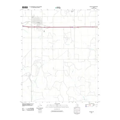
2010 Map of McLean
USGS Topo · Published 2010About this map
McLean serves as the focal point of this Panhandle landscape, where the town’s grid is defined by historical transportation corridors like Railroad St and the modern interstate highway. Just north of the town center, Hillcrest Cemetery stands as a significant site for genealogical research, while the McLean/Gray County Airport sits on the northern periphery near Co Rd Z.
Find a feature on this map
27 named features on this map. Tap any name to fly to it.
Don’t see what you’re looking for? This feature index may not catch every label — zoom into the map to look around manually.
Map Details
Editions of this 2010 McLean Map
This is the sole edition of this map. No revisions or reprints were ever made.
Other maps of this area

1954 · Amarillo
USGS Topo · 1:250,000

1958 · Amarillo
USGS Topo · 1:250,000

1959 · Troublesome Creek
USGS Topo · 1:24,000

1959 · Spencer Lake
USGS Topo · 1:24,000

1962 · Hudgens Ranch
USGS Topo · 1:24,000

1962 · Back
USGS Topo · 1:24,000

1962 · Pakan
USGS Topo · 1:24,000

1963 · Alanreed
USGS Topo · 1:24,000

1963 · Ramsdell
USGS Topo · 1:24,000

1963 · McLean
USGS Topo · 1:24,000