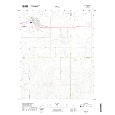
2019 Map of McLean
USGS Topo · Published 2019About this map
McLean sits at the northern edge of this West Texas landscape, where the grid of city streets meets the drainage networks of the Panhandle. The town’s layout is defined by the parallel paths of E Bus I 40 and the railroad corridor, with residential streets like Sitter St and Main St extending toward the Hillcrest Cem. To the east, the Mc Lean/Gray County Airport serves the region, positioned near the boundary where Gray, Wheeler, Donley, and Collingsworth counties converge.
Find a feature on this map
67 named features on this map. Tap any name to fly to it.
Don’t see what you’re looking for? This feature index may not catch every label — zoom into the map to look around manually.
Map Details
Editions of this 2019 McLean Map
This is the sole edition of this map. No revisions or reprints were ever made.
Other maps of this area

1954 · Amarillo
USGS Topo · 1:250,000

1958 · Amarillo
USGS Topo · 1:250,000

1959 · Troublesome Creek
USGS Topo · 1:24,000

1959 · Spencer Lake
USGS Topo · 1:24,000

1962 · Hudgens Ranch
USGS Topo · 1:24,000

1962 · Back
USGS Topo · 1:24,000

1962 · Pakan
USGS Topo · 1:24,000

1963 · Alanreed
USGS Topo · 1:24,000

1963 · Ramsdell
USGS Topo · 1:24,000

1963 · McLean
USGS Topo · 1:24,000