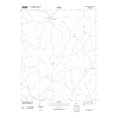
2010 Map of McLemoresville
USGS Topo · Published 2010About this map
McLemoresville serves as the primary hub of this Carroll County landscape, situated where the northern headwaters of Halley Creek and White Creek begin their descent. The terrain is defined by the winding course of the Rutherford Fork Obion River, which meanders through the central and southern portions of the quadrangle. This 2010 survey reveals a community deeply rooted in its local geography, with numerous family-named roads like Evins Rd and Giles Rd connecting historically significant sites. Genealogists will find a concentration of burial grounds including McLemoresville Cemetery, Mount Olive Cemetery, and Carters Chapel Cemetery. Water management is a visible priority across the countryside, evidenced by engineered features such as Beech Dam creating Beech Lake, along with the Robert Haney Dam and the Twin Lakes further south.
Find a feature on this map
54 named features on this map. Tap any name to fly to it.
Don’t see what you’re looking for? This feature index may not catch every label — zoom into the map to look around manually.
Map Details
Editions of this 2010 McLemoresville Map
This is the sole edition of this map. No revisions or reprints were ever made.
Other maps of this area

1936 · Clarksburg
USGS Topo · 1:24,000

1936 · Center Ridge
USGS Topo · 1:24,000

1950 · Palmer Shelter
USGS Topo · 1:24,000

1950 · Clarksburg
USGS Topo · 1:24,000

1955 · Huntingdon
USGS Topo · 1:24,000

1956 · Dyersburg
USGS Topo · 1:250,000

1956 · Blytheville
USGS Topo · 1:250,000

1959 · Blytheville
USGS Topo · 1:250,000

1966 · Spring Creek
USGS Topo · 1:24,000

1966 · Mc Lemoresville
USGS Topo · 1:24,000