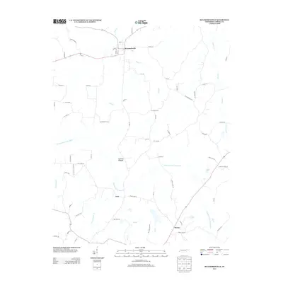
2013 Map of McLemoresville
USGS Topo · Published 2013About this map
McLemoresville serves as the primary hub in this rural landscape, situated just north of the meandering Rutherford Fork Obion River. This 2013 survey illustrates the enduring agricultural and residential patterns of Carroll County, where small clusters like Carters Chapel and Terry are connected by a network of named country roads and creeks. The hydrology of the region is prominent, defined by drainage systems such as Grassy Hollow Cr, White Cr, and Reedy Creek. Cultural landmarks such as Howley and recreation points like Beech Lake and Twin Lakes offer specific points of interest for local researchers. The presence of routes like Old Roberts Mill Rd and Christian Chapel Rd indicates the historical importance of local milling operations and community centers in this part of West Tennessee.
Find a feature on this map
71 named features on this map. Tap any name to fly to it.
Don’t see what you’re looking for? This feature index may not catch every label — zoom into the map to look around manually.
Map Details
Editions of this 2013 McLemoresville Map
This is the sole edition of this map. No revisions or reprints were ever made.
Other maps of this area

1936 · Clarksburg
USGS Topo · 1:24,000

1936 · Center Ridge
USGS Topo · 1:24,000

1950 · Palmer Shelter
USGS Topo · 1:24,000

1950 · Clarksburg
USGS Topo · 1:24,000

1955 · Huntingdon
USGS Topo · 1:24,000

1956 · Dyersburg
USGS Topo · 1:250,000

1956 · Blytheville
USGS Topo · 1:250,000

1959 · Blytheville
USGS Topo · 1:250,000

1966 · Spring Creek
USGS Topo · 1:24,000

1966 · Mc Lemoresville
USGS Topo · 1:24,000