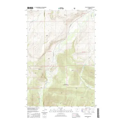
2017 Map of McLeod Basin
USGS Topo · Published 2017About this map
The settlement of Contact sits at the southern edge of this mountain landscape, positioned where Contact Cr and Fuller Gulch meet the larger river systems. The terrain is defined by high peaks and ridges within the Gallatin National Forest, including the prominent Contact Mtn, Tepee Mtn, and Green Mtn. This area in the high country of the Park Co Sweet Grass Co border region shows a transition from the lower elevations of the Boulder River and West Boulder River to the steep relief of Coal Mine Rim and McLeod Basin. Local landmarks such as Natural Bridge Draw and the uniquely named Boulder Bone Yard suggest a landscape shaped by both geological forces and long-standing local nomenclature. The map provides a detailed view of the high-altitude drainage systems and access routes like Main Boulder Rd that connect these remote mountain features.
Find a feature on this map
39 named features on this map. Tap any name to fly to it.
Don’t see what you’re looking for? This feature index may not catch every label — zoom into the map to look around manually.
Map Details
Editions of this 2017 McLeod Basin Map
This is the sole edition of this map. No revisions or reprints were ever made.
Other maps of this area

1891 · Livingston
USGS Topo · 1:250,000

1893 · Livingston
USGS Topo · 1:250,000

1940 · Mt. Cowen
USGS Topo · 1:62,500

1941 · Mt Douglas
USGS Topo · 1:62,500

1943 · Mt Douglas
USGS Topo · 1:62,500

1943 · Mt Cowen
USGS Topo · 1:62,500

1947 · Bozeman
USGS Topo · 1:250,000

1948 · Bozeman
USGS Topo · 1:250,000

1951 · Mount Rae
USGS Topo · 1:24,000

1951 · Squaw Peak
USGS Topo · 1:24,000