
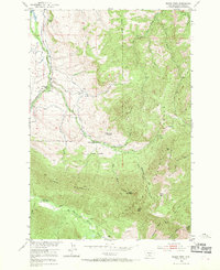
1951 Map of Squaw Peak
USGS Topo · Published 1953About this map
The Gallatin National Forest dominates this mid-century landscape in Sweet Grass County, where the high ridges of Long Mountain and Squaw Peak rise above the branching drainages of the Boulder River and East Boulder River. The 1951 field survey reveals a high-altitude territory in transition, where earlier pioneer efforts are marked by scattered remnants of habitation. Homesteading history is prominent along the canyon floors and mountain benches, evidenced by sites like the Mc Kinsey Homestead and several locations already listed as abandoned, including the Farnsworth Homestead and Sessongood Homestead. Evidence of early resource extraction persists through features such as Sawmill Ruins and Spring Ruins, while the East Boulder School serves as a lone institutional landmark in this sparsely populated terrain. The map also traces intricate water management infrastructure, including a Ditch and Flume near Enos Creek, which supported local agriculture or livestock in the foothills.
Find a feature on this map
40 named features on this map. Tap any name to fly to it.
Don’t see what you’re looking for? This feature index may not catch every label — zoom into the map to look around manually.
Map Details
Editions of this 1951 Squaw Peak Map
2 editions found
Other maps of this area

1891 · Livingston
USGS Topo · 1:250,000

1891 · Big Timber
USGS Topo · 1:125,000

1893 · Livingston
USGS Topo · 1:250,000

1893 · Big Timber
USGS Topo · 1:125,000

1898 · Granite Mountain District
USGS Topo · 1:125,000

1932 · Nye No 2
USGS Topo · 1:48,000

1939 · Mt Wood
USGS Topo · 1:62,500

1941 · Mt. Wood
USGS Topo · 1:62,500

1941 · Mt Douglas
USGS Topo · 1:62,500

1943 · Mt Douglas
USGS Topo · 1:62,500