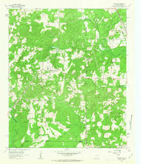
1962 Map of McLeod
USGS Topo · Published 1963About this map
The Kansas City Southern railroad cuts through this borderland where Texas meets Louisiana, defining the local landscape during the early 1960s. The region is heavily influenced by the petroleum industry, evidenced by numerous oil wells and gas wells dotting the terrain between McLeod and Walton. This energy infrastructure exists alongside deep-rooted rural institutions like the Good Exchange Ch and the Walnut Hill Ch, which served the small communities and scattered homesteads across Cass County and Caddo Parish.
Find a feature on this map
34 named features on this map. Tap any name to fly to it.
Don’t see what you’re looking for? This feature index may not catch every label — zoom into the map to look around manually.
Map Details
Editions of this 1962 McLeod Map
2 editions found
Other maps of this area

1907 · Atlanta
USGS Topo · 1:62,500

1910 · Atlanta
USGS Topo · 1:62,500

1932 · Hosston NW
USGS Topo · 1:31,680

1932 · Hosston SW
USGS Topo · 1:31,680

1944 · Kildare
USGS Topo · 1:62,500

1948 · Kildare
USGS Topo · 1:62,500

1948 · Vivian
USGS Topo · 1:62,500

1952 · Doddridge
USGS Topo · 1:24,000

1953 · Texarkana
USGS Topo · 1:250,000

1953 · El Dorado
USGS Topo · 1:250,000