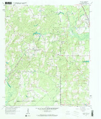
1962 Map of McLeod
USGS Topo · Published 1963About this map
Mc Leod and North Rodessa sit at the center of this 1960s landscape, where the borders of Cass County, Texas, and Caddo Parish, Louisiana, meet. The area is defined by a dense network of energy infrastructure, including numerous Oil Wells, Gas Wells, and a central Refinery, illustrating the region's mid-century reliance on the petroleum industry. Several rural anchors serve the community, such as Pleasant Hope Ch and Walnut Hill Ch, alongside family and community burial grounds like Good Exchange Cem and Bauguss Cem.
Find a feature on this map
37 named features on this map. Tap any name to fly to it.
Don’t see what you’re looking for? This feature index may not catch every label — zoom into the map to look around manually.
Map Details
Editions of this 1962 McLeod Map
2 editions found
Other maps of this area

1907 · Atlanta
USGS Topo · 1:62,500

1910 · Atlanta
USGS Topo · 1:62,500

1932 · Hosston NW
USGS Topo · 1:31,680

1932 · Hosston SW
USGS Topo · 1:31,680

1944 · Kildare
USGS Topo · 1:62,500

1948 · Kildare
USGS Topo · 1:62,500

1948 · Vivian
USGS Topo · 1:62,500

1952 · Doddridge
USGS Topo · 1:24,000

1953 · Texarkana
USGS Topo · 1:250,000

1953 · El Dorado
USGS Topo · 1:250,000