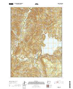
2020 Map of McLeod
USGS Topo · Published 2020About this map
McLeod serves as the focal point of this Jackson County landscape, situated near the confluence of the Rogue River and Big Butte Creek. The terrain is defined by dramatic elevation changes, rising from the river valley to prominent summits such as Tatouche Peak, Burnt Peak, and the distinctive Camel Hump. To the east, the waters of Lost Creek Lake dominate the geography, bordered by the recreational lands of Joseph Stewart State Park.
Find a feature on this map
41 named features on this map. Tap any name to fly to it.
Don’t see what you’re looking for? This feature index may not catch every label — zoom into the map to look around manually.
Map Details
Editions of this 2020 McLeod Map
This is the sole edition of this map. No revisions or reprints were ever made.
Other maps of this area

1891 · Ashland
USGS Topo · 1:250,000

1893 · Ashland
USGS Topo · 1:250,000

1897 · Ashland
USGS Topo · 1:250,000

1943 · Trail
USGS Topo · 1:62,500

1944 · Tiller
USGS Topo · 1:62,500

1944 · Abbott Butte
USGS Topo · 1:62,500

1947 · Abbott Butte
USGS Topo · 1:62,500

1954 · Butte Falls
USGS Topo · 1:62,500

1955 · Medford
USGS Topo · 1:250,000

1957 · Medford
USGS Topo · 1:250,000