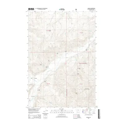
2014 Map of McLeod
USGS Topo · Published 2014About this map
The McLeod settlement marks a central point of human activity where the West Boulder River joins the Boulder River. This area of Sweet Grass County is defined by a dense network of coulees and canyons, with land use split between private holdings and the protected reaches of the Gallatin National Forest. The landscape is etched with named drainages such as Schoolhouse Gulch, Miles Gulch, and Decker Gulch, suggesting a history of local ranching and rural settlement. Prominent geological features like Antelope Butte and Castle Butte serve as significant landmarks against the rising elevation. Early transportation routes, including MT-298 and Susie Creek Rd, follow the natural contours of the river valleys, providing access to remote springs like the 02S13E11BBBC01 Spring and the high-country draws of the western front.
Find a feature on this map
39 named features on this map. Tap any name to fly to it.
Don’t see what you’re looking for? This feature index may not catch every label — zoom into the map to look around manually.
Map Details
Editions of this 2014 McLeod Map
This is the sole edition of this map. No revisions or reprints were ever made.
Other maps of this area

1891 · Livingston
USGS Topo · 1:250,000

1891 · Big Timber
USGS Topo · 1:125,000

1893 · Livingston
USGS Topo · 1:250,000

1893 · Big Timber
USGS Topo · 1:125,000

1947 · Bozeman
USGS Topo · 1:250,000

1948 · Bozeman
USGS Topo · 1:250,000

1951 · Squaw Peak
USGS Topo · 1:24,000

1951 · Kelly Hills
USGS Topo · 1:24,000

1951 · Springdale
USGS Topo · 1:24,000

1951 · Mc Leod Basin
USGS Topo · 1:24,000