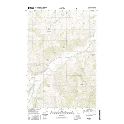
2017 Map of McLeod
USGS Topo · Published 2017About this map
The settlement of McLeod serves as the focal point for this landscape where the West Boulder River joins the Boulder River. This confluence area is marked by a complex network of named drainages and gulches, including Schoolhouse Gulch, Barn Gulch, and Michael Gulch, reflecting the localized nomenclature of Montana's ranching and wilderness history. A significant portion of the southeast is protected within the Gallatin National Forest, characterized by prominent elevations like Castle Butte. Transportation routes like Main Boulder Rd and Susie Creek Rd follow the natural contours of the river valleys, while the more remote Dehart Trl winds past Antelope Butte. The map details numerous smaller water sources, such as Whistle Cr and Castle Cr, which define the rugged terrain between the high buttes and deep draws like McComb Draw.
Find a feature on this map
37 named features on this map. Tap any name to fly to it.
Don’t see what you’re looking for? This feature index may not catch every label — zoom into the map to look around manually.
Map Details
Editions of this 2017 McLeod Map
This is the sole edition of this map. No revisions or reprints were ever made.
Other maps of this area

1891 · Livingston
USGS Topo · 1:250,000

1891 · Big Timber
USGS Topo · 1:125,000

1893 · Livingston
USGS Topo · 1:250,000

1893 · Big Timber
USGS Topo · 1:125,000

1947 · Bozeman
USGS Topo · 1:250,000

1948 · Bozeman
USGS Topo · 1:250,000

1951 · Squaw Peak
USGS Topo · 1:24,000

1951 · Kelly Hills
USGS Topo · 1:24,000

1951 · Springdale
USGS Topo · 1:24,000

1951 · Mc Leod Basin
USGS Topo · 1:24,000