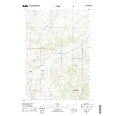
2020 Map of McLeod
USGS Topo · Published 2020About this map
McLeod serves as the focal point of this Sweet Grass County landscape, situated where the West Boulder River joins the main Boulder River. The map reveals a complex water management system essential to the region's agricultural life, featuring an extensive network of named irrigation channels such as the Mc Comb Campbell Ditch, Schmidelkoffer Dutton Vogers Ditch, and Loasby Ditch. These man-made waterways follow the natural contours of the land, cutting through the valleys between prominent rises like Antelope Butte and Castle Butte. To the south and east, the terrain transitions into the protected lands of the Gallatin National Forest. The map also preserves the names of numerous small drainages and gulches that define the local geography, including Schoolhouse Gulch, Decker Gulch, and Miles Gulch, providing a detailed look at the rural Montana backcountry and its historic land-use patterns.
Find a feature on this map
49 named features on this map. Tap any name to fly to it.
Don’t see what you’re looking for? This feature index may not catch every label — zoom into the map to look around manually.
Map Details
Editions of this 2020 McLeod Map
This is the sole edition of this map. No revisions or reprints were ever made.
Other maps of this area

1891 · Livingston
USGS Topo · 1:250,000

1891 · Big Timber
USGS Topo · 1:125,000

1893 · Livingston
USGS Topo · 1:250,000

1893 · Big Timber
USGS Topo · 1:125,000

1947 · Bozeman
USGS Topo · 1:250,000

1948 · Bozeman
USGS Topo · 1:250,000

1951 · Squaw Peak
USGS Topo · 1:24,000

1951 · Kelly Hills
USGS Topo · 1:24,000

1951 · Springdale
USGS Topo · 1:24,000

1951 · Mc Leod Basin
USGS Topo · 1:24,000