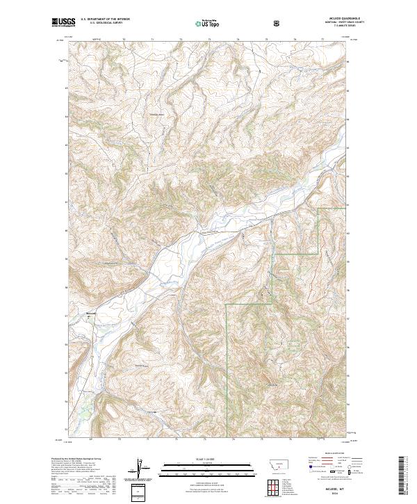
2024 Map of McLeod
USGS Topo · Published 2024About this map
The small unincorporated community of McLeod serves as the focal point of this Sweet Grass County landscape, situated where the West Boulder River joins the main Boulder River. The map reveals a complex system of early agricultural water management, evidenced by numerous irrigation channels including the Michael Ditch, Smoot Ditch, and the strikingly named Schmidelkoffer Dutton Vogers Ditch. This infrastructure highlights the historical necessity of diverting mountain runoff to support ranching in the valley below the rising slopes of Antelope Butte. To the east, the boundary of the Gallatin National Forest transitions from river bottomland into high-relief terrain marked by Castle Butte and numerous steep drainages like Corker Canyon and Schoolhouse Gulch. The road network, including the Main Boulder Rd and Susie Creek Rd, follows the natural contours of the river valleys, while interior access is provided by primitive routes such as the Dehart Trl.
Find a feature on this map
44 named features on this map. Tap any name to fly to it.
Don’t see what you’re looking for? This feature index may not catch every label — zoom into the map to look around manually.
Map Details
Editions of this 2024 McLeod Map
This is the sole edition of this map. No revisions or reprints were ever made.
Other maps of this area

1891 · Livingston
USGS Topo · 1:250,000

1891 · Big Timber
USGS Topo · 1:125,000

1893 · Livingston
USGS Topo · 1:250,000

1893 · Big Timber
USGS Topo · 1:125,000

1947 · Bozeman
USGS Topo · 1:250,000

1948 · Bozeman
USGS Topo · 1:250,000

1951 · Squaw Peak
USGS Topo · 1:24,000

1951 · Kelly Hills
USGS Topo · 1:24,000

1951 · Springdale
USGS Topo · 1:24,000

1951 · Mc Leod Basin
USGS Topo · 1:24,000