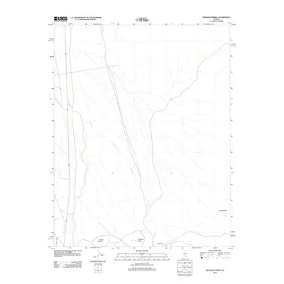
2012 Map of McMahon Ridge
USGS Topo · Published 2012About this map
McMahon Ridge and the surrounding Goldfield Hills define this high-desert landscape in the early 21st century. The terrain is marked by the prominence of Kendall Mountain and the dark profile of Black Butte to the south. This area serves as a significant drainage basin, with the extensive network of Big Wash winding through the center of the sheet, illustrating how seasonal water flow has historically shaped the local topography. Human infrastructure is limited to utility and access routes, such as Power Line Rd in the southwest corner. The map documents a sparsely settled region where the physical geography remains the dominant feature, providing a clear record of the land before further modern development or changes in land use patterns occurred.
Find a feature on this map
6 named features on this map. Tap any name to fly to it.
Don’t see what you’re looking for? This feature index may not catch every label — zoom into the map to look around manually.
Map Details
Editions of this 2012 McMahon Ridge Map
This is the sole edition of this map. No revisions or reprints were ever made.
Other maps of this area

1908 · Lida
USGS Topo · 1:250,000

1913 · Lida
USGS Topo · 1:250,000

1945 · Goldfield
USGS Topo · 1:125,000

1952 · Mud Lake
USGS Topo · 1:62,500

1952 · Goldfield
USGS Topo · 1:62,500

1954 · Goldfield
USGS Topo · 1:250,000

1955 · Goldfield
USGS Topo · 1:250,000

1958 · Goldfield
USGS Topo · 1:250,000

1962 · Goldfield
USGS Topo · 1:250,000
1970 · Klondike
USGS Topo · 1:24,000