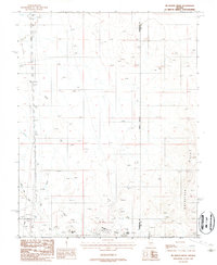
1987 Map of McMahon Ridge
USGS Topo · Published 1988About this map
McMahon Ridge and the surrounding Goldfield Hills define this high-desert mining landscape on the border of Esmeralda and Nye counties. This provisional study reflects the intense geological exploration of the late 1980s, revealing a dense concentration of prospects, mine shafts, and an adit scattered across the arid terrain. The map captures the infrastructure of mineral extraction and transit, from the modern Silver Peak Road to the historic Old Railroad Grade running through the western sections. Water management in this dry environment is evidenced by the presence of the Aqueduct and Ramsey Well. Rising above the desert floor, prominent landmarks such as Kendall Mtn and Black Butte provide topographic anchors for a region defined by its industrial subsurface activity and sparse surface water sources like Big Wash.
Find a feature on this map
17 named features on this map. Tap any name to fly to it.
Don’t see what you’re looking for? This feature index may not catch every label — zoom into the map to look around manually.
Map Details
Editions of this 1987 McMahon Ridge Map
This is the sole edition of this map. No revisions or reprints were ever made.
Other maps of this area

1908 · Lida
USGS Topo · 1:250,000

1913 · Lida
USGS Topo · 1:250,000

1945 · Goldfield
USGS Topo · 1:125,000

1952 · Mud Lake
USGS Topo · 1:62,500

1952 · Goldfield
USGS Topo · 1:62,500

1954 · Goldfield
USGS Topo · 1:250,000

1955 · Goldfield
USGS Topo · 1:250,000

1958 · Goldfield
USGS Topo · 1:250,000

1962 · Goldfield
USGS Topo · 1:250,000
1970 · Klondike
USGS Topo · 1:24,000