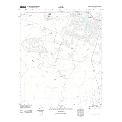
2010 Map of McMillan Mountains
USGS Topo · Published 2010About this map
Robert Gray Army Air Field and the surrounding military infrastructure anchor this 2010 landscape, illustrating the logistical footprint near the western edge of Killeen. The transition from residential expansion in Kay Bee Heights and Montague Village to the training grounds of the McMillan Mountains reveals a complex intersection of civilian and army life. Family history is preserved through several small burial grounds scattered across the terrain, including Henderson Cemetery near Montague Lake and Browns Cemetery along Ammo Rd. The landscape is defined by its drainages, where Reese Creek and North Reese Creek flow past elevations like Manere Mountain and Bald Knob, while specialized facilities like Camp Moonraker and the Finlayson Youth Camp occupy the gaps between the heights.
Find a feature on this map
53 named features on this map. Tap any name to fly to it.
Don’t see what you’re looking for? This feature index may not catch every label — zoom into the map to look around manually.
Map Details
Editions of this 2010 McMillan Mountains Map
This is the sole edition of this map. No revisions or reprints were ever made.
Other maps of this area

1893 · Georgetown
USGS Topo · 1:125,000

1894 · Gatesville
USGS Topo · 1:125,000

1930 · Killeen
USGS Topo · 1:62,500

1947 · Fort Hood
USGS Topo · 1:62,500

1947 · Fort Hood
USGS Topo · 1:24,000

1947 · Post Oak Mountain
USGS Topo · 1:24,000

1947 · Killeen
USGS Topo · 1:62,500

1947 · McMillan Mountains
USGS Topo · 1:24,000

1947 · Killeen
USGS Topo · 1:24,000

1947 · Twin Moutains
USGS Topo · 1:24,000